Key Takeaways for Running the Exercise
Summary: This mapping exercise teaches participants to read a camp as an interdependent system, not as a set of separate facilities.
- Purpose: Make spatial trade-offs visible across water, sanitation, shelter, health care, roads, drainage, and distribution points.
- Materials: A large base map, transparent overlays, colored markers, removable stickers, scenario cards, a timer, and a facilitator note sheet.
- Time structure: Use a short briefing, timed mapping rounds, pressure-event cards, and a structured debrief. The majority of the session should be spent mapping, not listening to a lecture.
- Learning outcome: Participants should explain why one infrastructure choice changes another, especially where routes, queues, water access, sanitation, and drainage collide.
The exercise works best when the facilitator treats it as a teaching simulation. It is not a camp design template, a technical site plan, or a substitute for professional humanitarian assessment.
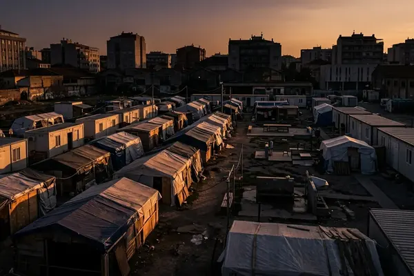
That distinction matters. A participant may place a clinic in a central location and appear to solve access on paper, then discover that the same road also carries water trucks, food distribution traffic, and waste removal teams. The lesson is not that the clinic was “wrong.” The lesson is that camp infrastructure behaves as a connected field system.
Core teaching aim
The central goal is to make participants see interaction. Water points affect crowd movement. VIP latrine placement affects drainage and night access. Roads shape ambulance routes. Food distribution points create queues that can block a clinic entrance. Shelter density changes how far people walk for bathing areas, schools, and waste disposal.
The facilitator should protect that complexity without turning the room into a design competition.
What the Map Exercise Teaches Beyond Map Reading
Infrastructure mapping gives students, journalists, and early-career humanitarian practitioners a way to see decisions that are usually hidden inside coordination meetings. A camp map can look orderly when printed at the end of a planning process. During the exercise, the same map becomes a record of trade-offs.
One group may keep water points near shelters to reduce walking distance. Another may move them closer to an access road because trucking and maintenance need reliable vehicle movement. Both choices can be reasonable. The educational value comes from comparing the consequences.
Static features and dynamic systems
Participants often begin by placing static features: shelter blocks, latrine blocks, clinics, schools, and distribution sites. Those are necessary, but they do not show how the camp functions each day.
The facilitator should quickly draw attention to dynamic systems: water trucking routes, waste removal paths, patient referral movement, drainage flow, crowd movement after distribution, and night access to sanitation. The curriculum design should prioritize these moving systems over the simple placement of pins.
A useful prompt is simple: “Who needs to move through this space every morning, and what blocks them?” That question shifts the map from geography to operations.
Field-informed reasoning without engineering calculations
The exercise does not require participants to calculate pipe sizing, road bearing capacity, or drainage channel volume. Instead, it trains them to ask the first-order questions that come before those calculations: where water can be delivered, where runoff will go, which route remains open during rain, and which service point creates congestion.
As a classroom method, it can introduce standards-based thinking without claiming to validate a real design.
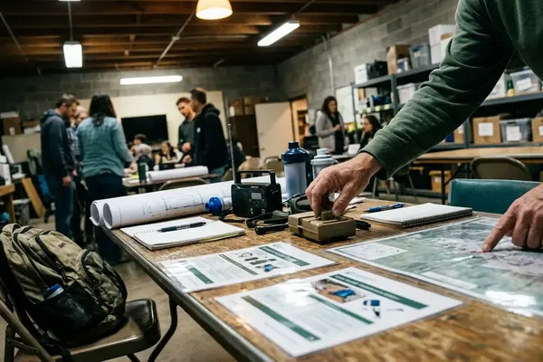
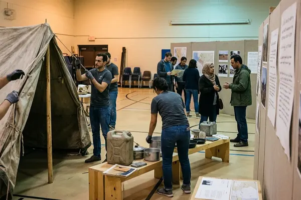
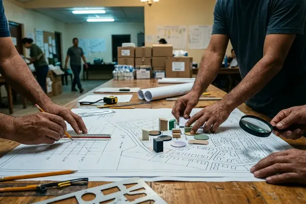
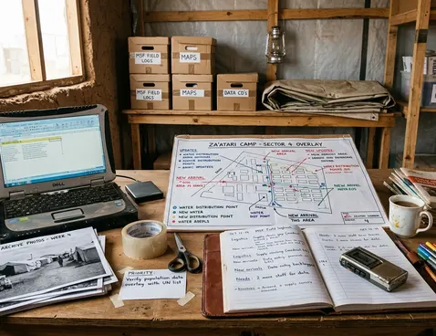
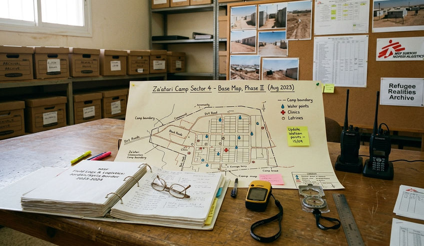
Preparation: Base Map, Scenario Pack, and Materials
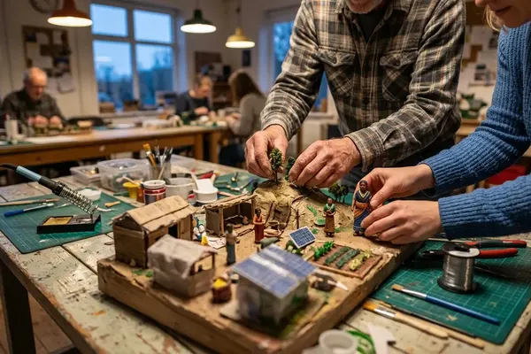
Preparation determines whether the exercise produces useful friction or polite guessing. The base map should be fictional, but it should feel constrained enough that participants cannot place facilities anywhere they like.
Build the base map
The facilitator should create a base map that includes terrain, one or more access roads, population zones, flood-prone edges, existing service points, and areas that are visibly unsuitable for some activities. A roughly 3 to 5 percent slope is enough to force a real drainage discussion if contour lines are readable.
An A0 or A1 size printed base map at about a 1:2000 scale representation works well because participants can stand around it, argue over routes, and revise decisions without crowding the paper.
Early versions of this kind of exercise sometimes rely on a blank grid. That keeps preparation easy, but it removes the very constraints participants need to practice reading. A light slope, a road pinch point, and a wet edge produce better learning than a perfect rectangle.
Prepare the scenario pack
The scenario pack should define the fictional camp context, arrival pattern, terrain constraints, available services, and obvious unknowns. It should not imitate an identifiable real camp unless the material is public, appropriate, and stripped of sensitive operational detail.
Scenario cards can describe heavy rain, a road closure, increased arrivals, clinic congestion, a fuel shortage, or damaged water storage. These cards should be held back until after the first mapping round.
Set out the materials
- Large printed base map
- Transparent overlays for infrastructure layers
- Colored markers
- Removable stickers or tabs
- Scenario cards
- Timer
- Facilitator note sheet for recording assumptions, conflicts, and unresolved questions
Quick Tip: Assign colors before the session starts. Use distinct symbols for water points, latrines, bathing areas, clinics, food distribution, schools, waste zones, drainage, lighting, and vehicle routes.
Step-by-Step Facilitation Sequence
The sequence should be staged to reveal blind spots. If the facilitator explains every constraint before participants start, the room becomes cautious. If groups map first, their early assumptions become visible.
1. Give the scenario briefing
Start with a brief five-minute introduction. Define the fictional camp context, the arrival pattern, the terrain constraints, and the services already in place. Keep it short enough that participants feel some uncertainty.
The facilitator should state the boundary conditions clearly: this is a logistics and infrastructure reasoning exercise, not a role-play of displacement or loss.
2. Divide participants into working groups
Assign small groups or roles such as water and sanitation, health, logistics, protection, and camp coordination. The roles are not meant to create rivalry. They help participants notice that each sector sees the map differently.
3. Place the first layer before discussing constraints
Ask groups to place their first infrastructure layer quickly. Shelter and water are useful starting points because they expose assumptions about distance, movement, and access.
Then introduce access road constraints, slope, or existing service limitations. This staged reveal often shows why an apparently tidy layout fails under ordinary field conditions.
4. Run timed mapping rounds
Use mapping rounds of roughly 12 to 15 minutes. Short rounds force groups to decide what information matters most, while still leaving enough time to revise the map after discussion.
- Round one: place core services and main movement routes.
- Round two: add sanitation, drainage, waste, and security lighting.
- Round three: introduce a pressure event and require groups to adjust the map.
- Final pass: mark unresolved questions rather than hiding them.
Infrastructure Layers Participants Should Map
The exercise works better when participants map layers rather than isolated facilities. A latrine block is not just a sanitation object. It depends on terrain, safe access, privacy, desludging or waste removal routes, and distance from water sources.
Movement and access
Movement should come early. Participants should mark pedestrian routes, vehicle routes, ambulance access, service roads, and expected crowd movement after distribution. The common mistake is to leave roads as empty white space until the end.
Food distribution queues can block ambulance access to a clinic. Water trucking can churn wet soil near shelters. Waste removal routes can conflict with school access if the group only thinks about shortest paths.
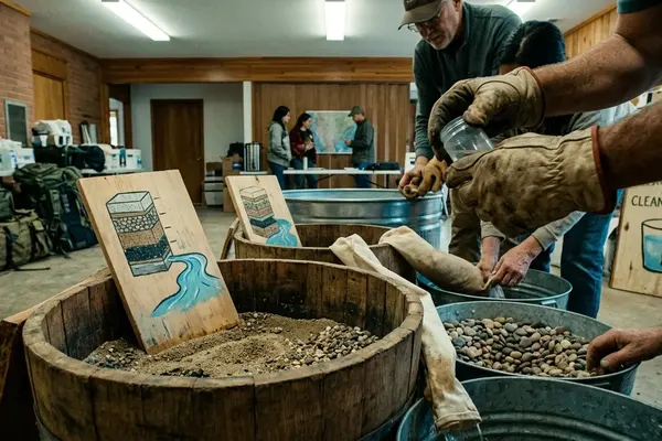
Water, sanitation, and drainage
Water points, latrine blocks, bathing areas, and drainage should be mapped together. The Sphere Handbook is a useful reference for standards-based discussion, including the commonly used minimum distance of about 30 meters between latrines and groundwater sources where that standard applies: Sphere Handbook.
A specific error is worth watching for: placing latrines uphill from water points because the group ignored topographical contour lines on the base map. That mistake is teachable because it connects sanitation, water safety, slope, and map literacy in one decision.
Health, distribution, waste, and lighting
Health clinics depend on clear routes, visible access, and referral movement. Distribution sites depend on queue space, crowd flow, and separation from vehicle traffic. Waste zones require service access without pushing hazards into daily pedestrian routes.
- Water points: Depend on access roads for trucking and maintenance; often conflict with runoff and mud near shelters.
- Latrine blocks: Depend on distance from water sources; often conflict with safe night access and privacy.
- Health clinics: Depend on ambulance and referral routes; often conflict with market, school, or distribution congestion.
- Drainage: Depends on slope and outflow paths; often conflicts with shelter expansion and latrine placement.
- Security lighting: Depends on movement routes and service points; often conflicts with privacy, maintenance limits, and uneven coverage.
Pressure Events: Adding Field Constraints Without Sensationalism
Pressure events should reveal interdependence, not dramatize suffering. The facilitator is testing the map, not the emotional endurance of participants.
Choose cascading constraints
Good scenario cards trigger a chain of operational effects. A fuel shortage affects water pumping or trucking, which changes collection times, which changes crowding, which may increase pressure around sanitation and distribution routes. A damaged water storage point can do the same.
A two-day simulated heavy rainfall event is especially useful because it touches nearly every layer: drainage, road access, latrine stability, clinic access, waste movement, and shelter conditions.
Keep the discussion professional
Pressure cards should be written in plain operational language. “Main access road closed after heavy rain” is enough. There is no need to add dramatic personal details.
Note: The facilitator should stop any pressure event that pushes participants into role-playing trauma, displacement, or personal loss. The learning objective is infrastructure reasoning.
Monitoring reports show that field teams often spend significant effort reconciling competing access, service, and safety priorities. In the classroom, that reality can be represented through constraints without turning the exercise into a performance of crisis.
Debrief: From Colored Lines to Operational Reasoning
The debrief should not grade the prettiest map. It should identify bottlenecks, unresolved trade-offs, and missing information.
Start with what changed
Ask each group to name one decision they changed after a pressure event. Then ask what stayed unresolved. This avoids the defensive tone that appears when participants think there is a single correct layout.
Program evaluation revealed that the strongest learning often comes when groups explain why they could not solve a conflict cleanly. A water point may need road access, but the best road location may increase mud near shelter blocks. A clinic may need a central location, but central routes may already carry distribution queues.
Use bottleneck questions
- Which service point became a bottleneck first?
- Which route failed under pressure?
- Which decision would require community consultation before implementation?
- Which infrastructure layer depended on information the group did not have?
- Which group had a priority that conflicted with another group’s plan?
The facilitator should record these answers on the note sheet. The list becomes more useful than the final map because it shows how participants reasoned under time pressure.
Adjust for participant background
The same exercise should not be run identically for every audience. Public-health graduate students may need more emphasis on water safety, sanitation placement, disease prevention logic, and community consultation. Early-career logistics practitioners may need more detail on vehicle access, storage points, maintenance routes, fuel constraints, and distribution flow.
Adjusting the scale and scenario complexity is not a concession. It is how the facilitator keeps the exercise technically honest.
Scope, Safety, and Limitations of the Exercise
This exercise is for education and training discussion. It is not for designing a real refugee camp, approving a site plan, or replacing professional humanitarian assessment.
Protect sensitive operational detail
Facilitators should avoid using identifiable real camp layouts unless the map is already public, appropriate for the audience, and stripped of sensitive operational details. Even then, a fictional composite is usually safer and cleaner for teaching.
The map should not expose security arrangements, vulnerable service locations, staff movement patterns, or community-level details that could place people at risk.
Do not simulate personal loss
The introduction should establish strict boundaries on role-play. Participants should not be asked to act out trauma, family separation, violence, displacement, or bereavement.
There is enough technical difficulty in the infrastructure problem itself.
Know where the model does not fit
One catch: this exercise assumes a greenfield camp scenario. It does not translate well to urban displacement or host-community integration settings where existing municipal infrastructure dictates much of the response.
That limitation should be named before the debrief ends. A good mapping exercise teaches participants to read constraints; it should also teach them to recognize when the exercise frame is too narrow for the setting in front of them.